Preloader Close

completed UPT
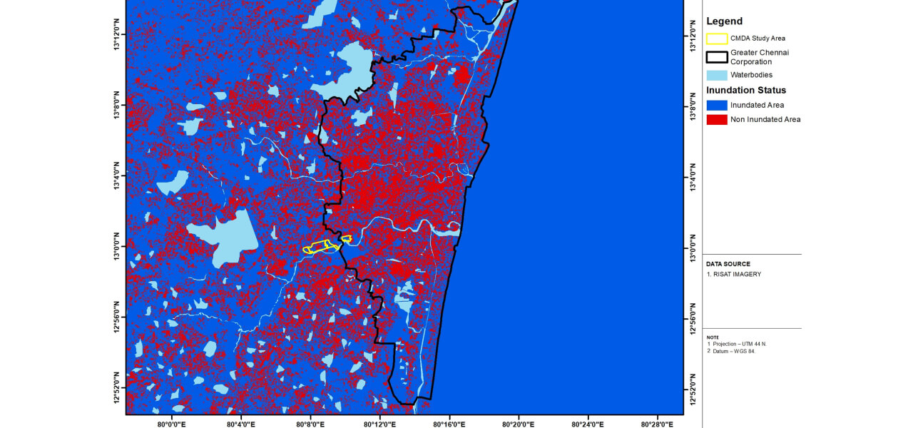
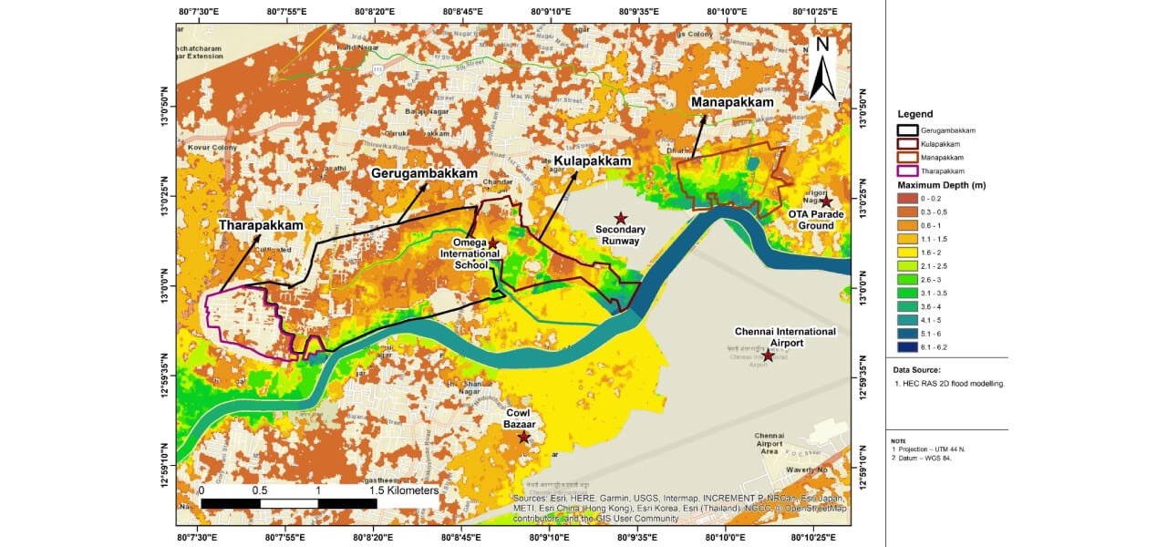
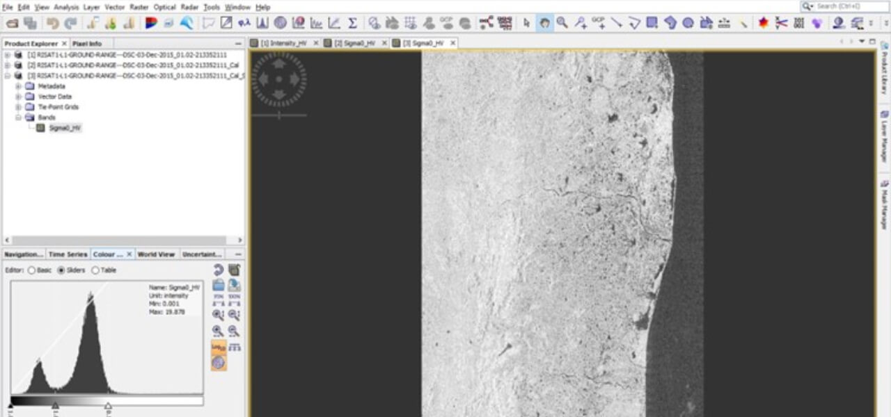
Preparation of flood inundation maps for a site area of 645 acres falling in villages of Manapakkam, Gerugambakkam, Kulapakkam and Tharapakkam located along the Adyar River
Services
- Hydrological and Hydraulic Analysis
- Flood and Inundation Modelling
- Risk Assessment Evaluating flood risk and vulnerability
- Regulation Recommendations for appropriate land use and site-specific measures to mitigate flood risks.
- Assisted CMDA in making informed decisions regarding land development regulations, urban planning, and disaster preparedness measures.
Description & Brief scope
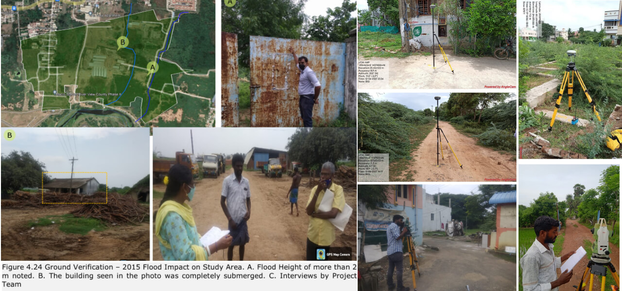
Unprecedented flooding in the Adyar river in 2015 caused severe inundation in many areas on the both sides of the river. Taking congnisance of the high inundation levels in the study area, Chennai Metropolitian Development Authority (CMDA) had appointed CUBE to carry out a study to prepare flood inundation maps for the study area to assist them in assigning appropriate land use and suggesting suitable site measures and regulations.
Key Highlights
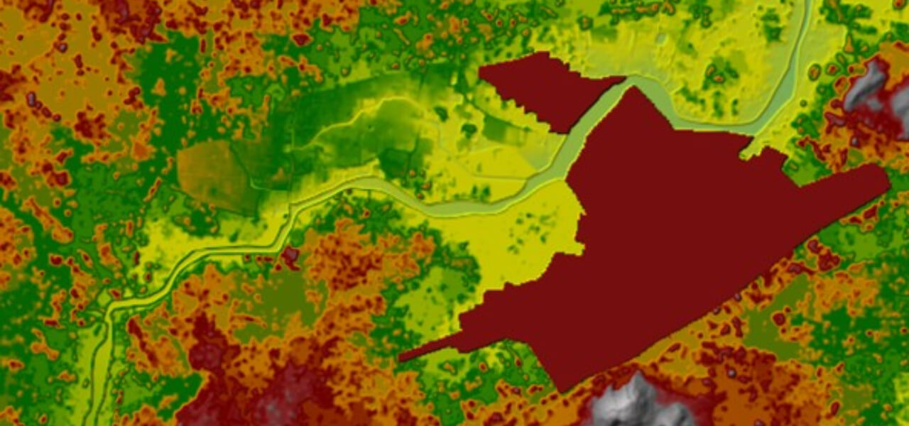
Flood Risk Management: Project creates precise flood vulnerable maps for a 645-acre area in adjacent Adyar River's villages for the critical years 2005,2015,2017& 2020.In addition to this vulverable maps were generated for five year and 10 year return period peak rainfall intensities. This aids CMDA in effective flood mitigation measures.
Smart Urban Planning: CUBE' s findings and recomendations guides in allocating appropiate land use, regulations, and site measures, promoting safer urban growth.
Enhanced Safety: Study's flood predictions improve community safety by guiding CMDA in measures that safeguard vulnerable residents.
Facts and Figures
Client
Chennai Metropolitan Development Authority
Start Date
2021
End Date
Jan 2021 - Dec 2021
Location
Chennai
Partners & Associates
NA
Image Gallery: